
Geography facts that they didn’t teach us in school
Trending Now
Our planet is an astonishingly diverse and awe-inspiring place, filled with a multitude of geographical wonders and cultural intricacies. It’s easy to assume that you have a solid understanding of the world, but a closer look at maps and some research can quickly reveal just how much there is still to discover.
The Earth is a treasure trove of fascinating places waiting to be explored, and once you start uncovering its hidden gems, you’ll be inspired to pack your bags and embark on new adventures. From unusual natural formations and remote locales to cultural nuances and uncharted territories, the world is full of surprises that will ignite your wanderlust and make you want to book a plane ticket and see it all for yourself.
Mount Everest Isn’t The Tallest Mountain In The World
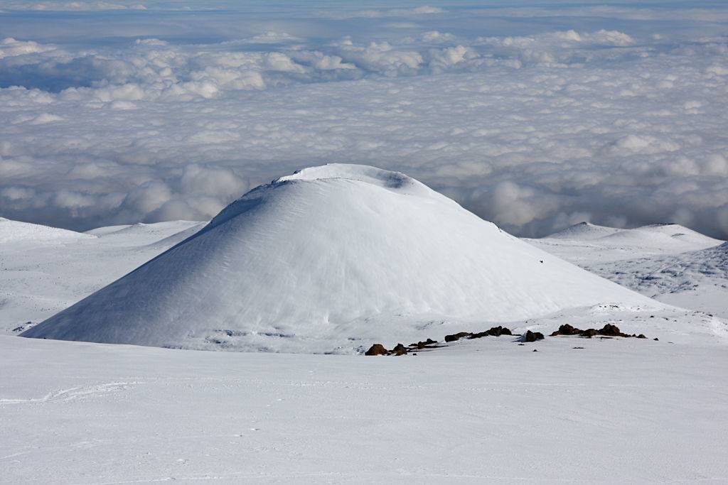
Mount Everest is arguably the most well-known mountain in the world, with people risking their lives every year to conquer it. Yet, it’s a common misconception that it’s the tallest mountain in the world.
While it may be the tallest mountain above sea level, when it comes to the tallest mountain on Earth, that title goes to Mauna Kea. Located in Hawaii, above sea level, Maua Kea is only 13,769 feet, but from its base at the bottom of the Pacific, it’s 32,80 feet, 3,000 feet taller than the mighty Everest.
Mexico City Is Sinking Into The Earth
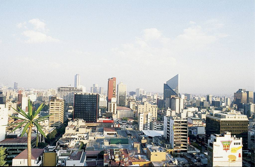
Mexico City was initially built on a lake in 1325 A.D., however, the Mexico City we see today is sinking around 3.2 feet every year. Before the arrival of the Europeans, the Aztecs filled in Lago de Texcoco in order to create an artificial island, which the Spaniards built on top of the ruins in 1521.
However, because the locals rely on the water that is taken from beneath the city, Mexico City has sunk an unbelievable 32 feet over the last 60 years!
There Are More Than 7,600 Islands In The Philippines
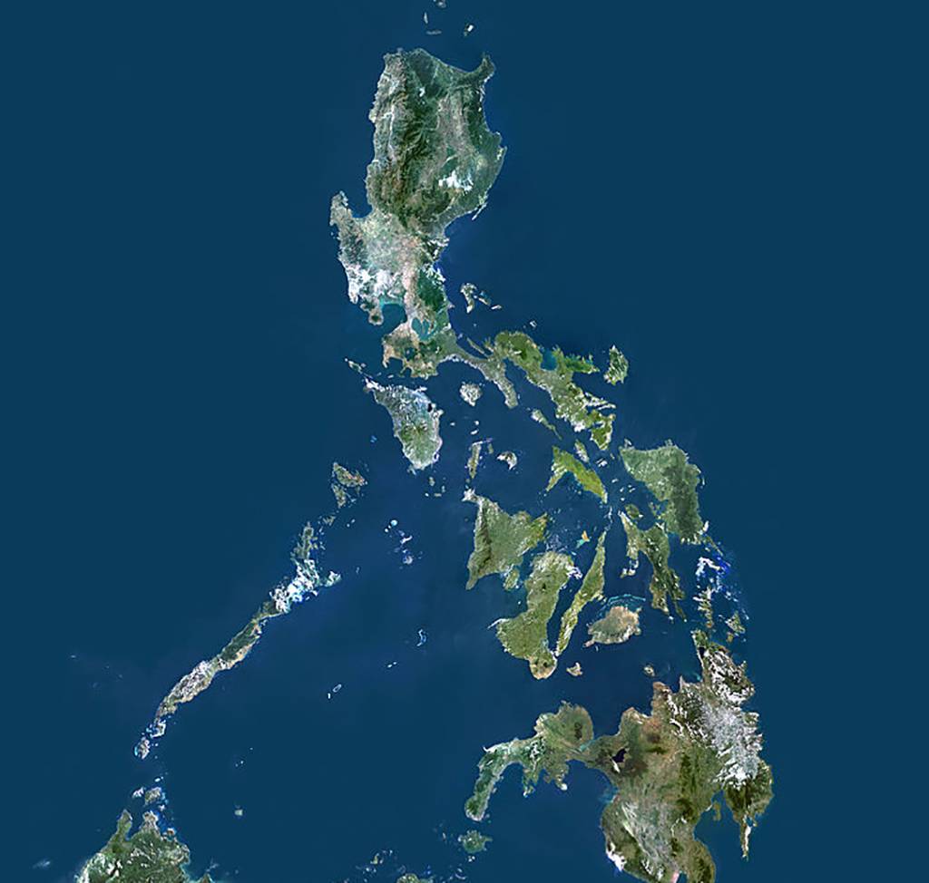
While there’s a reason that the Philippines are often referred to as the Philippine Islands, there are more than most people think. In total, in the Archipelago of the Philippines, there are more than 7,641 islands, which is several more than the 7,107 islands researchers believed the country previously contained.
This led The Inquirer to admit, “The change is a reminder of how knowledge, even scientific knowledge, is a matter of faith…It’s good for our critical thinking to be reminded of the contingency of ‘expert knowledge.'”
Alaska Is Both The Westernmost And Easternmost Part Of The United States
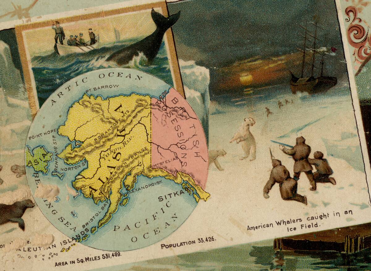
From a quick glance at a map, Alaska may clearly seem to be the United States’ westernmost state. While this is true, it is also the easternmost part of the country as well.
This is possible because it stretches so far to the west that it falls into the eastern hemisphere. To top it all off, the Semisopochnoi Island, which part of Alaska’s Aleutian Islands, is technically the easternmost part in all of North America.
Morning And Night Happen At The Same Time In Russia

Even considering Russia’s massive size, it’s still incredible to learn that Russia has a whopping 11 time zones out of the 24 in the entire world! This means that on one side of Russia, the country is waking up at 7 am, while the other side is about to sit down for dinner.
A bonus fun fact is that France uses one more time zone than Russia because of all of their different overseas territories.
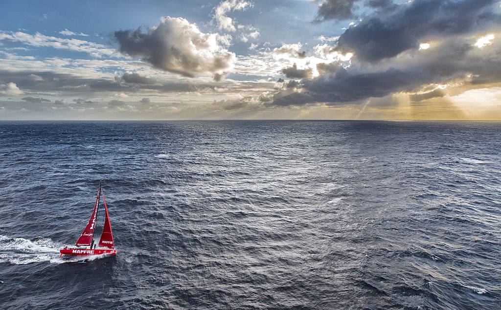
The Sargasso Sea Has No Coasts
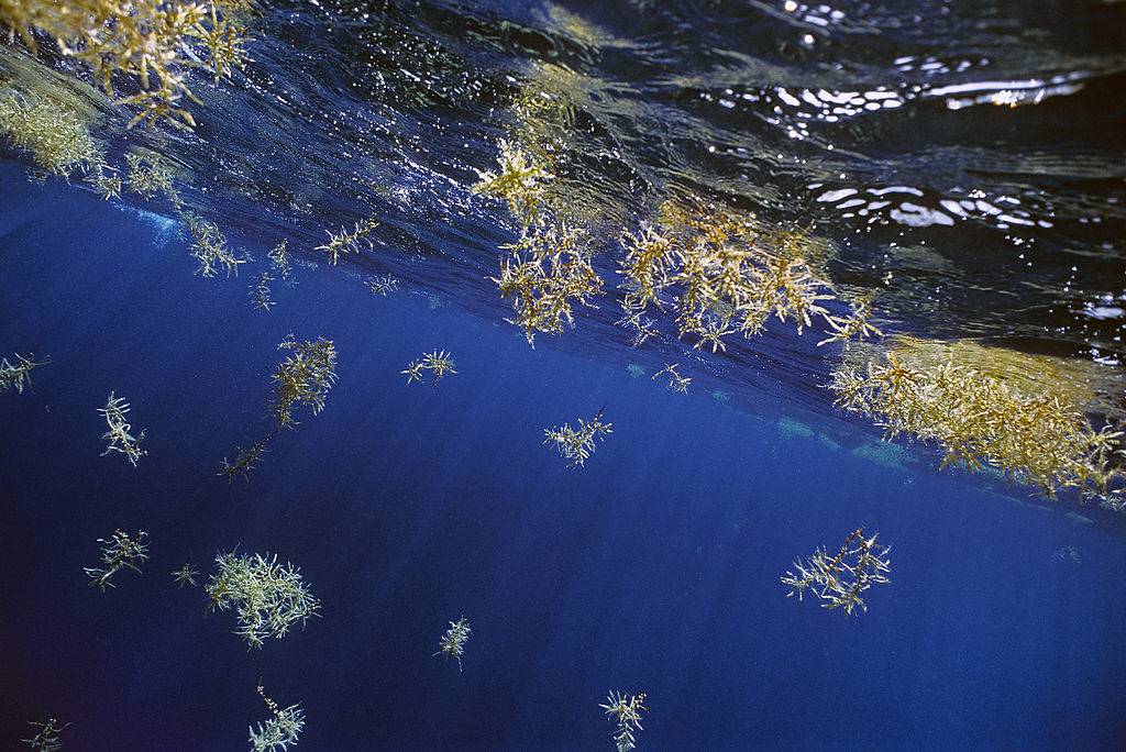
While it may seem obvious that any body of water has to have some kind of coast or ridge line to separate it from a landmass, that’s not the case of the Sargasso Sea: the only sea without any coasts.
It is located in the Atlantic Ocean in the North, where it is surrounded by four ocean currents, with no land. It is given its name for the Sargassum seaweed that covers it all over.
The Largest Rock In The World Is In Australia
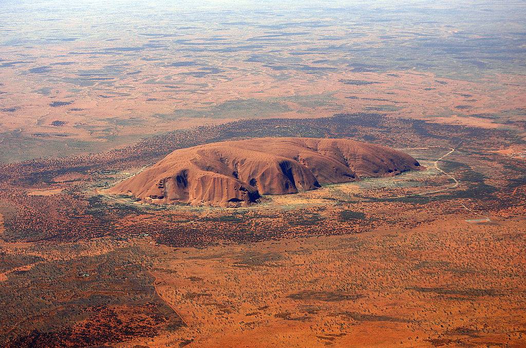
Although it has the name of Mount Augustus, it is not a mountain, but actually one massive rock. It can be found in the Australian Outback, standing more than 2,300 feet tall, and can be visible for more than 100 miles away.
Incredibly, this mammoth boulder is more than twice the Ayers Rock’s size, which is the much more famous granite rock. On top of all that, Mount Augustus is also 1,650 million years old!
Two Islands Just 2.4 Miles Apart Are Also 20 Hours Apart
In between the United States and Russia are the Diomede Islands, in which the two countries divide. Big Diomede is located in Russia and Little Diomede in America, which are separated by both the International Border and Date Line.
However, it is because of this that even though the island is just 2.4 hours apart, there is also a 20-hour time difference between the two. Because of this, Big Diomede is also referred to as Tomorrow Island, and Little Diomede is Yesterday Island.
Damascus Is The Oldest Continuously Inhabited City In The World
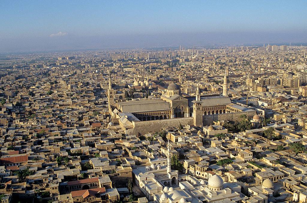
Cities such as Athens and Egypt may come to mind as the oldest cities in the world, but it’s actually Damascus, Syria. Since at least 11,000 years ago, it has been continuously inhabited and was eventually named the Arab Capital of Culture in 2008.
Today, Damascus has more than 125 monuments from various times in the city’s history, going back to the 3rd millennium BC. Currently, the city is home to more than 1.7 million people.
The State Of Kentucky Has More Caves Than Anywhere On Earth
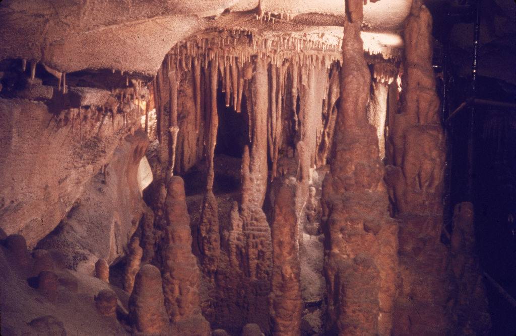
Officially known as the Commonwealth of Kentucky and nicknamed the Bluegrass State, Kentucky is the 37th most extensive and 26th most populous of the 50 United States. Furthermore, it is also home to the world’s largest cave system known as Mammoth Cave.
The system is more than 400 miles long (of which has been explored), with researchers believing that there are more than 200 miles of unexplored underground systems. Tourists can even visit parts of the cave in Mammoth National Park.
It Snows In The Sahara Desert
The Sahara Desert is considered one of the hottest places on Earth, with temperatures reaching more than 136 degrees Fahrenheit. With the temperatures this high, one would think that this region would never see snow, but that’s not the case.
While the desert’s average temperature is 86 degrees, in the evenings, it can drop to an average of 25 degrees fahrenheit. Unbelievably, in January 2018, it received its third snowfall in 40 years, with the previous being in 2016 and 1979.
A Heart Can Be Seen At The Great Barrier Reef
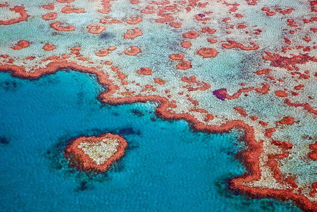
The largest living organism on Earth, the Great Barrier Reef spans 1,429 miles of coastline of Australia. As if it isn’t beautiful enough, if you’re flying above it, you can see part of the reef that’s in the shape of a heart.
The first pilot that ever spotted it flew overhead in 1955. The “heart” is 55 feet in diameter and is part of the Hardy Reef in Whitsunday’s. Unsurprisingly, you’re not allowed to get close enough to it by boat.
Everest Isn’t The Closest Mountain To The Moon

Not only is Mount Everest not the tallest mountain in the world, and even though it’s the tallest mountain above sea level, it’s also not even the closest mountain to the moon. This prestigious honor, in fact, goes to Mount Chimborazo.
This is possible because our planet isn’t actually a sphere, as most people think, but actually, an oval inflated in the middle. In Ecuador, Mount Chimborazo may only be 20,564 feet in height, but because the equator pushes it up, it is closer to the moon than Everest by 1.5 miles.
Africa Spans All Four Hemispheres
Africa is the world’s second-longest and second-most-populous continent after Asia. In total, it covers 6% of Earth’s total surface area and 20% of its land area, with a population of 1.3 billion people as of 2018.
As if that wasn’t impressive enough, it is also the only continent in the world to cover the north, south, east, and west hemispheres, totaling 12 million square miles. Today, Africa is made up of 54 countries, the largest being Algeria.
Water Covers Most Of The Planet Although Humans Can’t Use It
Amazingly, the planet is covered by more than 71 percent of water, yet humans can actually consume only .007 percent of it. This is because only 2.5 percent is freshwater, with the rest being saline and ocean-based.
Even then, only 1 percent is readily accessible, with the rest of it being trapped in glaciers and snowfields around the planet. That sure is a lot of undrinkable water on the planet!
There’s A Piece Of Land In North Carolina That Belong To England
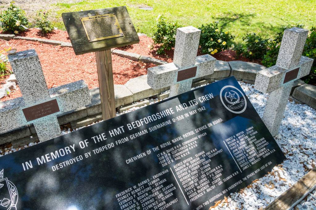
Along the Outer Banks of North Carolina in the town of Ocracoke, is a piece of land that is leased forever to England. The piece of land is a cemetery and memorial that honors the HTM Bedfordshire, which was an English naval ship that patrolled the waters during World War II.
When the ship was sunk by a German U-boat, all 37 sailors perished and most bodies were never recovered. However, four bodies did wash on the shore and were buried in a cemetery that was leased to England so the men can be buried on their home ground.
It Takes A Drop Of Water 90 Days To Travel Down The Mississippi River
The Mississippi River is the second-longest river and the second-largest drainage system on the North American continent. The river either borders or passes through Minnesota, Wisconsin, Iowa, Illinois, Missouri, Kentucky, Tennessee, Arkansas, Mississippi, and Louisiana.
The river is so long, measuring at 2,348 miles, that it would take a drop of water 90 days from the northernmost source in Minnesota to its end in the Gulf of Mexico. That’s a lot of time for a single drop of water!
The Country With The Longest name Has 56 Characters
The United Kingdom’s official name is the United Kingdom of Great Britain and Northern Ireland, which is the most characters in a country’s full name. However, that wasn’t always the case.
Libya once held the record at 63 characters when it once went under the name Al Jumahiriyah al Arabiyah al Libiyah ash Shabiyah al Ishtirakiyah al Uzma. Its name was changed in 2013 officially to the State of Libya. We’re going to say that’s probably for the best.
It Snows In Hawaii
Although Hawaii is known for its tropical environment, its volcanoes are tall enough that they appear to be a whole other world at the top, stripped of their palm trees and salty air. They’re so tall, in fact, that they even get snow during some parts of the year.
For example, Mauna Kea and Mauna Loa on the Big Island, and Haleakala on the island of Maui are all above 10,000 feet and are known to receive snow during the winter months.
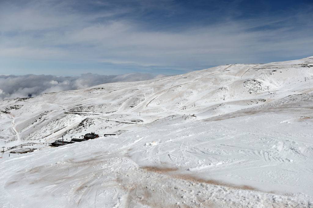
Australia’s Alps Get More Snow Than The Swiss Alps
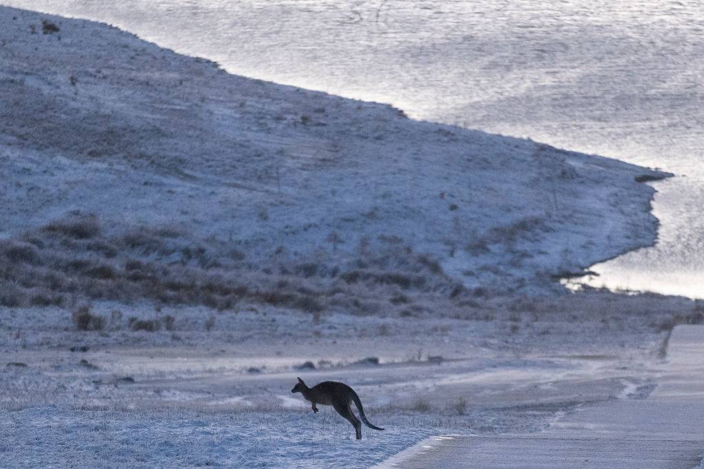
A lot of people assume that Australia is nothing more than beaches and deserts, but they are dead wrong. Along the border of New South Wales and Victoria reside the Australian Alps, which are a popular destination for Australians to have some fun in the snow during the winter months of June to September.
If that isn’t crazy enough, the Australian Alps actually receive more snowfall than the Swiss Alps because of their proximity to the coast.
There Is A Supervolcano Beneath Yellowstone National Park
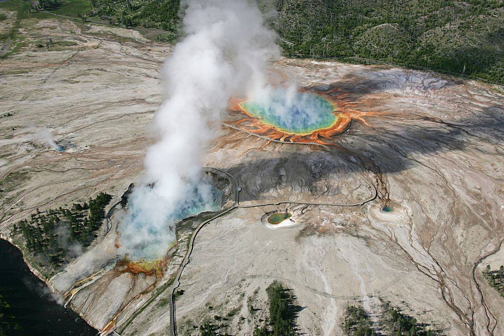
Yellowstone National Park may be considered one of the most impressive in the United States; it’s also home to an active supervolcano. According to National Geographic, a supervolcano explosion could release more than 240 cubic miles of materials, around twice the volume of Lake Eerie.
The Yellowstone volcano has actually erupted on three separate occasions, although the most recent one was over 640,000 years ago. Unfortunately, this also means that it’s overdue, although not likely to erupt anytime soon.
The Largest Sand Island On Earth Is In Australia
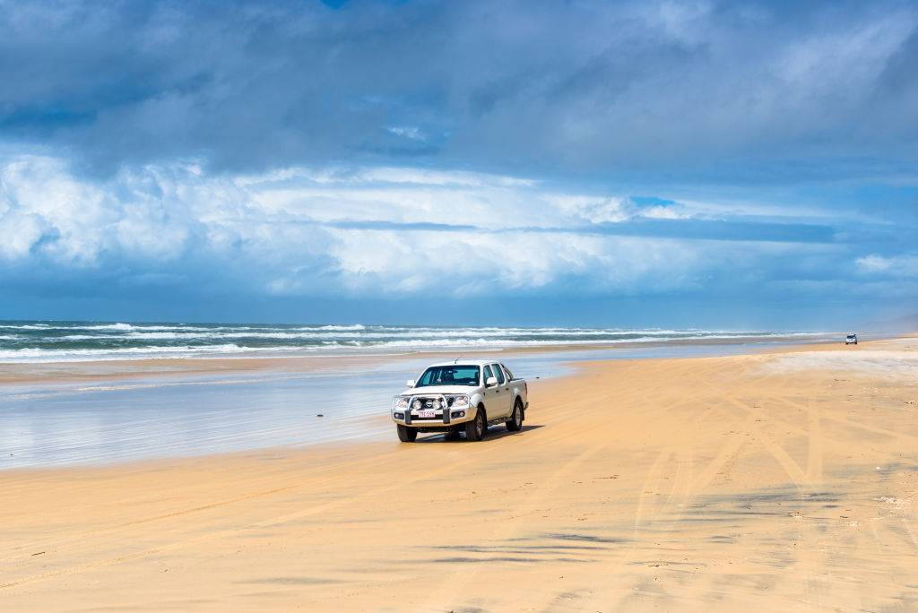
Located in Australia, Fraser Island was formed by sand blowing across the land for thousands upon thousands of years. Its length is around 76 miles with its width being approximately 14 miles.
It was established as a World Heritage Site in 1992 and is the largest sand island in the world. It is the traditional land of the Butchulla people and according to the 2016 census, had a small population of just 182 people.
There Are Floating Islands In Peru On A Lake
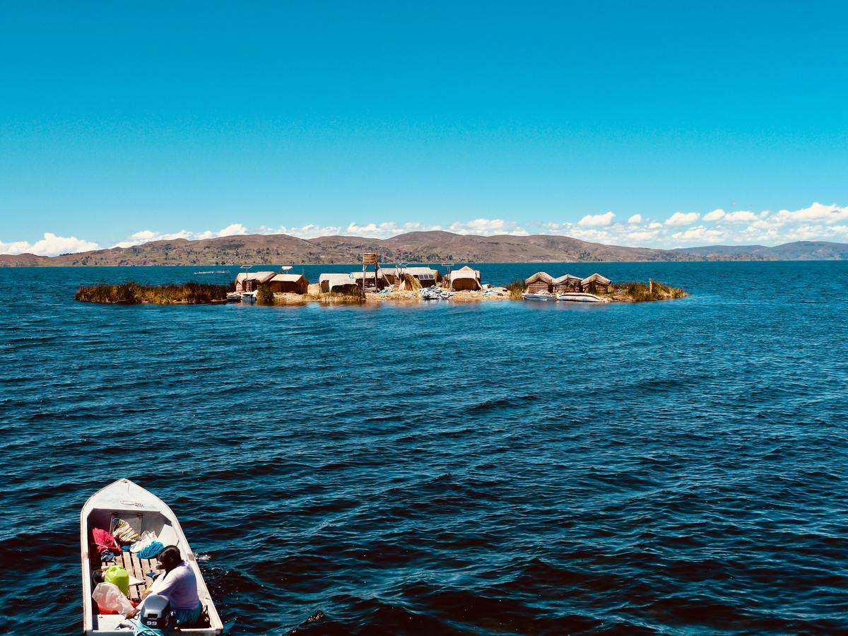
Above Peru in Lake Titicaca is a tribe of individuals that call floating islands made of reeds their homes. By stacking numerous piles of reeds, they create small islands that not only float but can withstand the weight of numerous structures at once.
Initially, the small floating island city of Puno was built this way so the people could easily escape danger. However, time never seemed to get to this small village and it has remained more or less the same.
The Shortest Flight In The World Is Just 57 Seconds

Why someone would ever take it, few have few answers, but if you wanted to, the shortest commercial flight in the world can be taken between Westray and Papa Westray in Scotland. The 1.7-mile flight connects the two islands and takes a grand total of 57 seconds depending on the weather.
The real question is how much that under one-minute flight costs. It’s safe to assume most people buy a ticket just to say they did it.
Los Angeles Is East Of Reno, Nevada
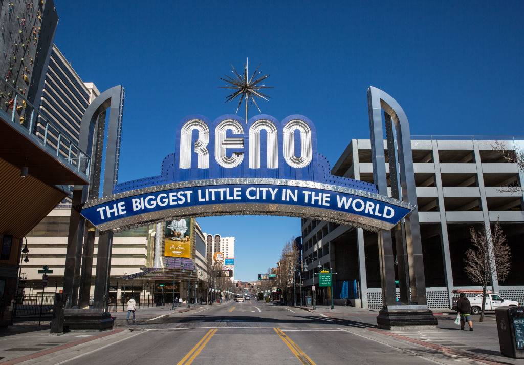
It’s common knowledge that California is west of Nevada, considering that it’s the westernmost coastline of the United States and Nevada is landlocked. What people don’t always realize is that the city of Los Angeles, California is actually East of Reno, Nevada.
Los Angeles is actually a whole 86 miles east of Reno, which is crazy to think about when Nevada is around 300 miles from the Pacific Ocean. Don’t let logic fool you when it comes to geography!
Istanbul Is The Only Major City That Rests On Two Continents
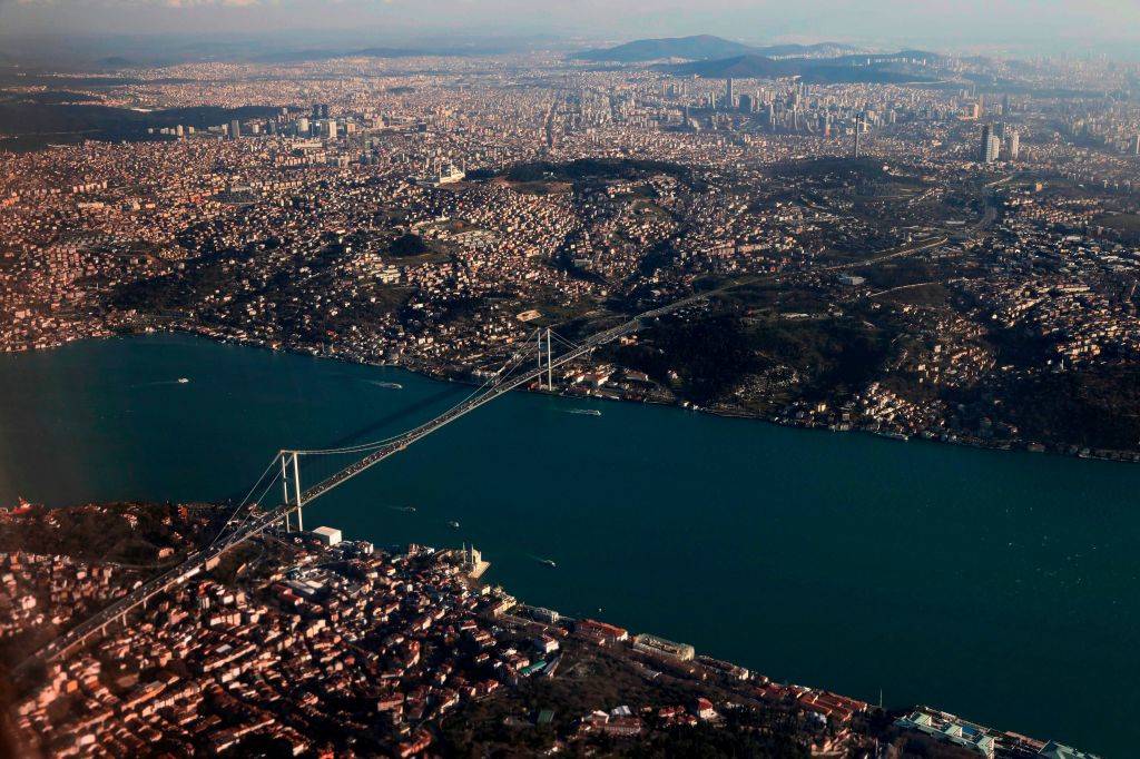
Istanbul is a major city and the only one that is located in both Europe and Asia, with the Bosphorus Strait running right through the middle. A bridge connects the two parts of the city, with the European half being the most populous and serving as the city’s historical center.
Istanbul is the largest city in Turkey with a history that goes over 2,000 years and as a population of more than 14 million people. In the past, it has served as the capital of the Roman, Byzantine, and Ottoman Empires.
Russia Has The Coldest Inhabited Place On Earth
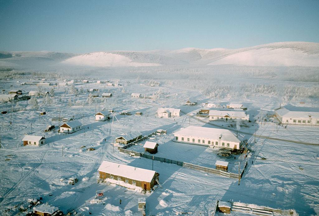
By a stretch, Russia is home to the coldest permanently inhabited place on Earth. This is mostly because the residents of Antarctica do not live in permanent towns, as they move around.
This Russian location is Oymyakon, Russia, which in 1924, reached a staggering low of -96.16 degrees Fahrenheit. Nevertheless, this region is not always this cold, and its average temperature resides somewhere around a still bone-chilling -58 degrees Fahrenheit. Hard to believe anyone would want to live there.
Russia And China Touch 14 Countries Each
It’s no secret that Russia and China are two of the largest countries in the world, despite the fact that China could fit comfortably in Russia, both each border 14 other countries. Russia, which includes the region of Kalinigrad borders Azerbaijan, Belarus, China, Estonia, Finland, Georgia, Kazakhstan, Latvia, Lithuania, Mongolia, North Korea, Norway, Poland, and Ukraine.
On the other hand, China borders Afghanistan, Bhutan, India, Kazakhstan, Kyrgyzstan, Laos, Myanmar, Mongolia, Nepal. North Korea, Pakistan, Russia, Tajikistan, and Vietnam.
Sudan Has More Pyramids Than Egypt
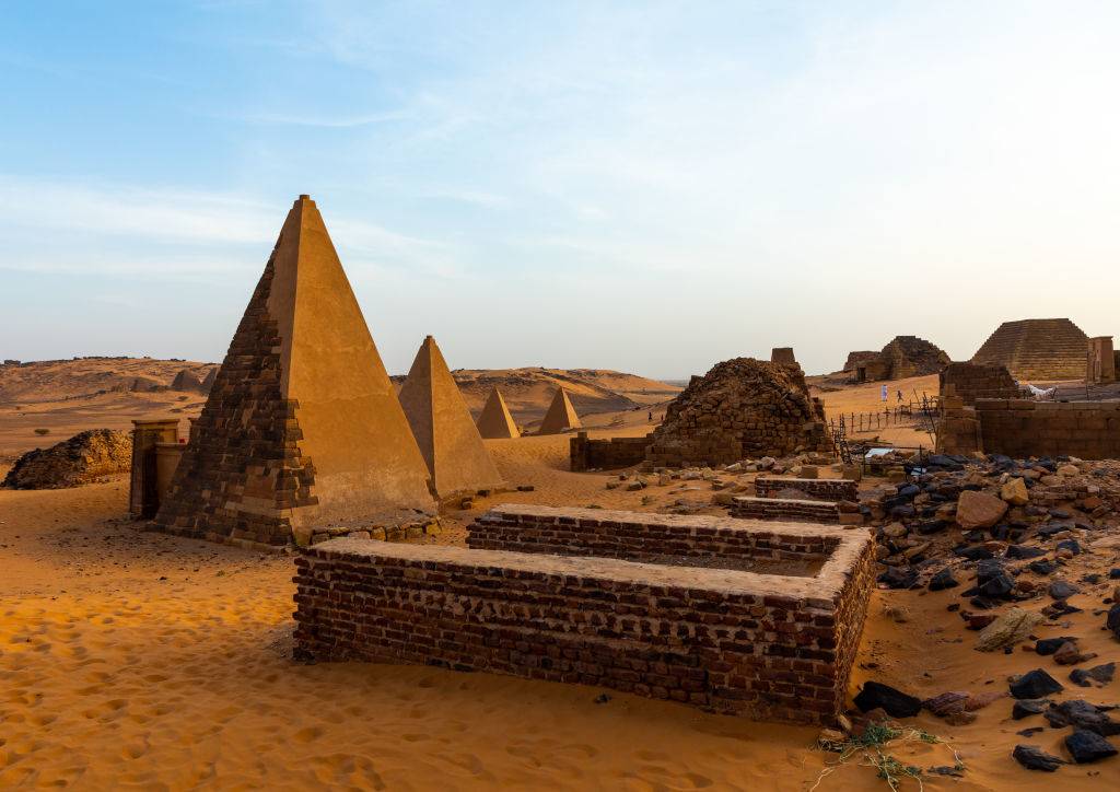
When discussing ancient pyramids, Egypt might come first to mind for most people, being so well known for its Pyramids of Giza.
Nevertheless, although Egypt is closely associated with pyramids, Sudan has nearly twice the amount of these ancient structures. Sudan has between 200 and 255 known pyramids, which were built for the Kushite kingdoms of Nubia, which is significantly more than Egypt’s 138 pyramids. Today, you can visit Sudan’s ancient and reconstructed pyramids of Meroe.
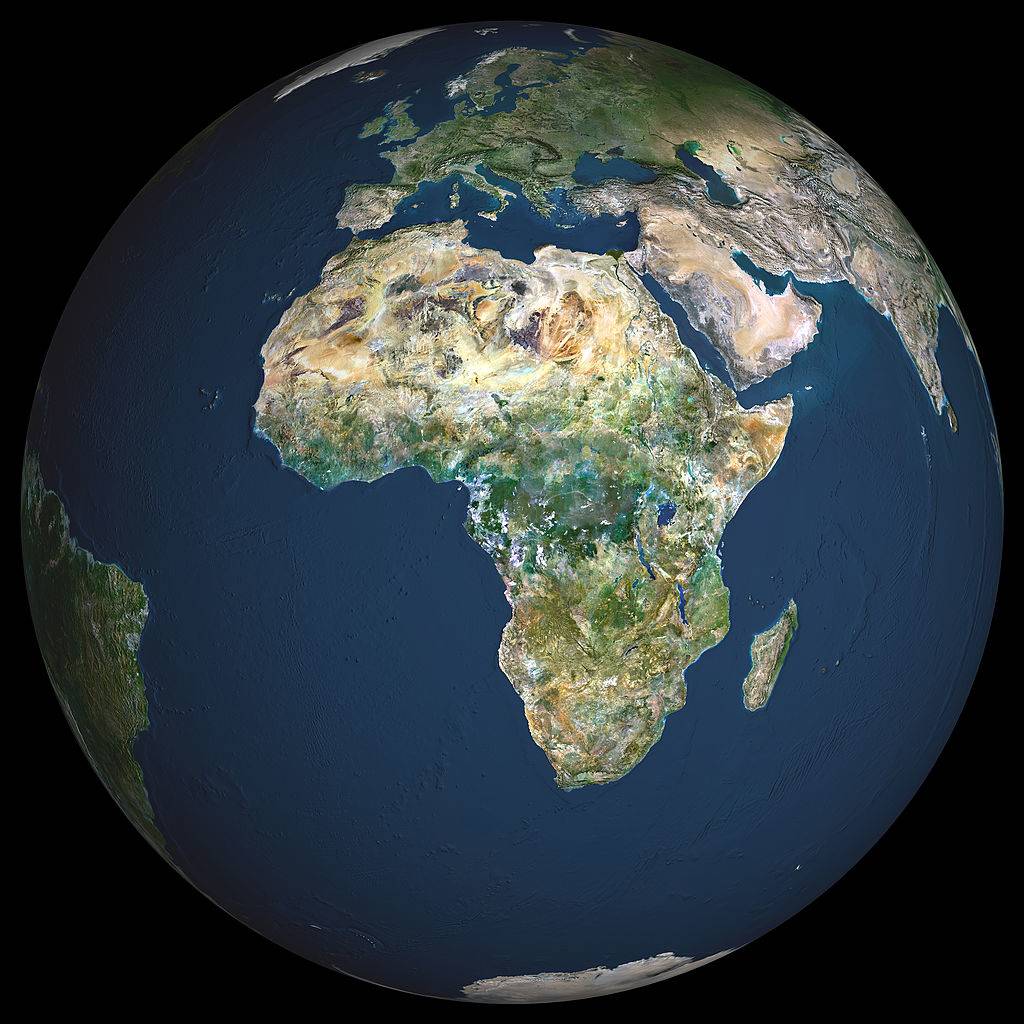
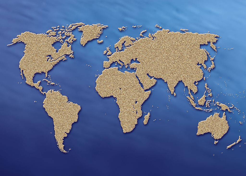
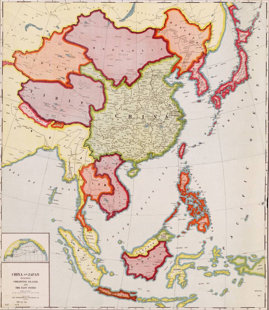
All World Maps Lie To People At Least A Little
According to LiveScience, this is an inherent problem of trying to translate a three-dimensional planet into a two-dimensional map like the one shown here. The results will leave some countries appearing larger than they are, smaller than they are, or with a distorted distance between them.
As Matthew Edney of the University of Southern Maine told the outlet, “Do you want the regions to be shaped as they are on a globe, or sized as they are on a globe? For most purposes, the latter is much more
appropriate, but the aesthetic of the former is still culturally
hegemonic.”
Continents Drift At The Same Rate As Fingernails Grow
As Popular Science noted, continents went through periods of slow and fast motion after Pangea started breaking up. Nonetheless, the average rate of movement for them was about 20 millimeters per year, which is the equivalent of about 0.7 inches.
And while this isn’t something that most people will wish to confirm for themselves, that’s also how quickly fingernails grow if they’re left uncut for long enough. That definitely makes it clear how long it took the continents to end up where they are now.
Australia Is Technically Wider Than The Moon
According to Snopes, it’s both accurate and misleading to describe Australia as wider than the Moon. And to clarify, “wider” does not necessarily mean the same thing as “larger.” Because the Moon’s land area easily dwarfs the smallest continent.
However, it’s also true that the Moon’s equatorial diameter is about 2,160 miles. Since Australia’s width is approximately 2,485 miles, it’s fair to say that it is slightly wider than that specific measurement of the Moon.
It’s A Long Way Down From Mt. Thor
Although Mt. Thor — located on Baffin Island in the Canadian territory of Nunavut — is far from the tallest mountain in the world, there’s one unique feature that makes it an attractive challenge for climbers throughout the world.
According to Atlas Obscura, that feature is its steep, 105-degree cliff face. The unique formation of the mountain makes this cliff the site of the world’s longest purely vertical drop. If something were to fall from this spot, it would travel 4,101 feet (or 0.78 miles) before it hit the ground.
The Dead Sea Is Shrinking And Sinking
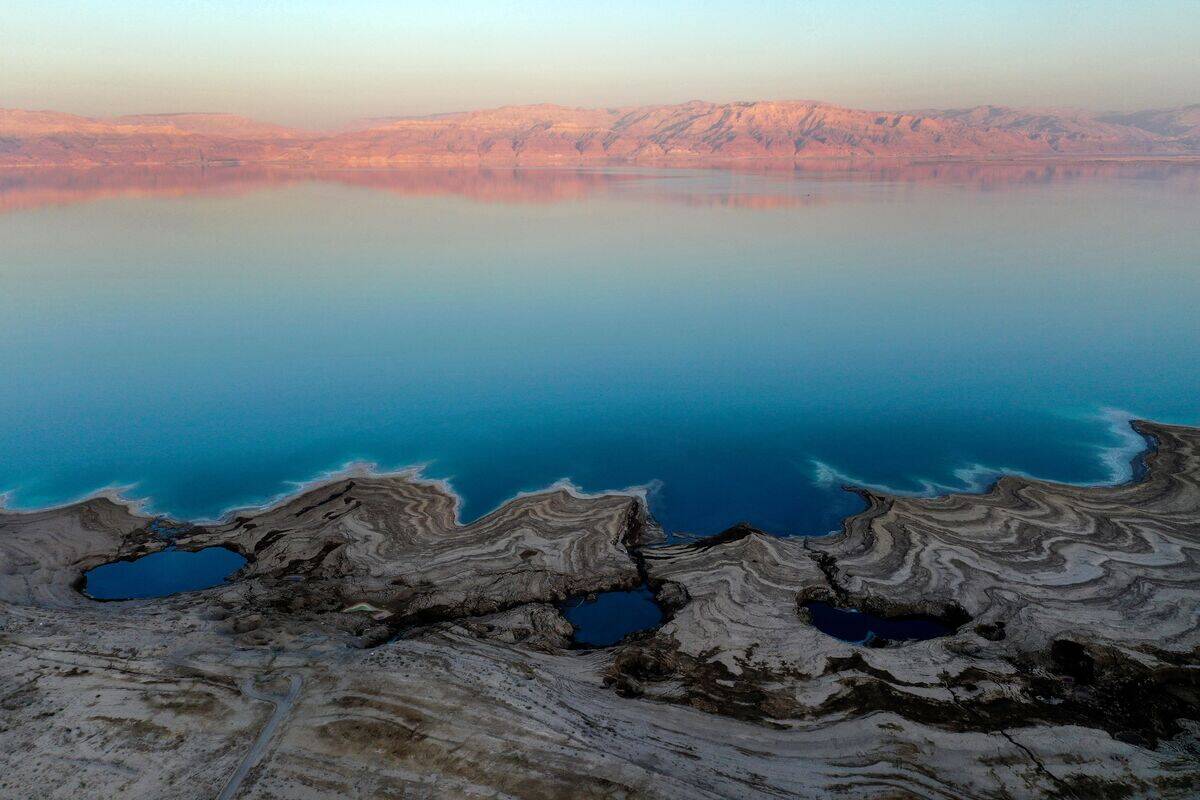
Typically, a body of water recedes and depletes because droughts or other climate issues cause the water line to lower. But in the case of Israel’s Dead Sea, the problem is more fundamental. While it’s true that the water line is consistently lowering there over time, the Dead Sea’s actual surface area is also shrinking.
According to the Smithsonian Magazine, that’s because the past 15 years have seen over 1,000 sinkholes form in the Dead Sea, which are slowly eating away at it and threatening the aquifers and hotels that surround it.
The Vatican Is The World’s Smallest Country
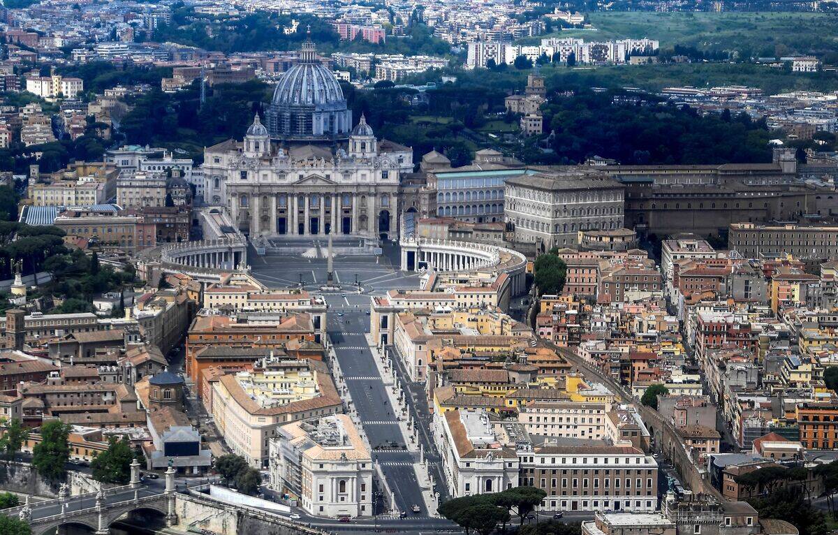
Although it’s easy to forget that Vatican City is a country at all, the headquarters of the Roman Catholic Church that’s nestled in Rome, Italy, is indeed its own separate nation-state. And it’s small enough that a person could reasonably explore its total area in an afternoon.
Specifically, the total area of the Vatican is just 0.19 square miles, which is about an eighth the size of New York City’s Central Park. The population is also very small for a distinct nation at, between 800 and 900 people.
Iceland Is Growing A Little Each Year, But It All Balances Out
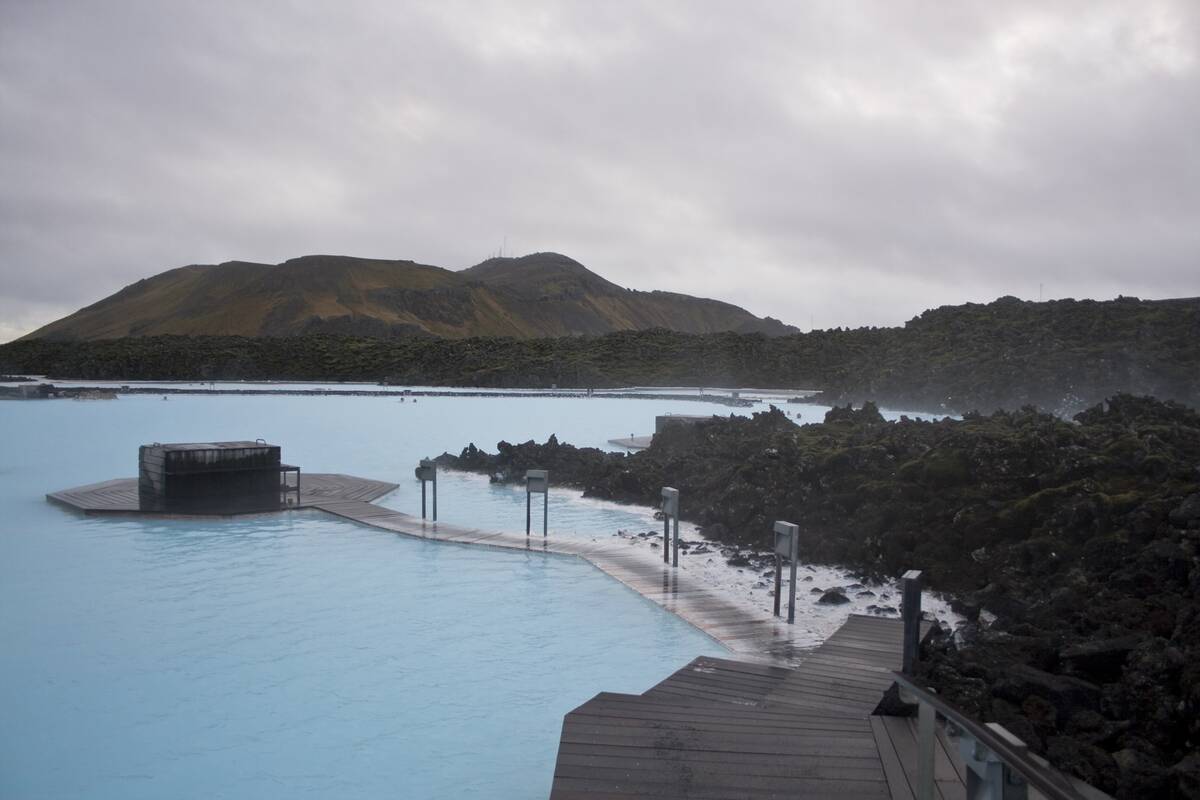
According to Visit Iceland, the middle of the island nation’s landmass is growing by about two centimeters (or about 0.8 inches) every year. This is because of drifting between the North American and Eurasian tectonic plates. Since the area sits right between the plates, it stretches out as they slowly spread apart.
However, this doesn’t mean that Iceland itself is growing because its outer edges are experiencing erosion at roughly the same rate as this growth. Easy come, easy go.
San Francisco And Los Angeles Will Be Neighbors One Day
Although California’s two biggest cities are indeed on a course that will push them next to each other, the day when they meet won’t come anytime soon and may not be so noticeable when it does.
According to The New York Times, the San Andreas fault that cuts through California is shifting in a way that pushes southern California northward at an average rate of about two inches per year. And while this rate isn’t exactly consistent, the gradual force will eventually put Los Angeles near San Francisco’s North Beach in an estimated 10.6 million years.
Italy Is The Only Country To Entirely Landlock Two Others
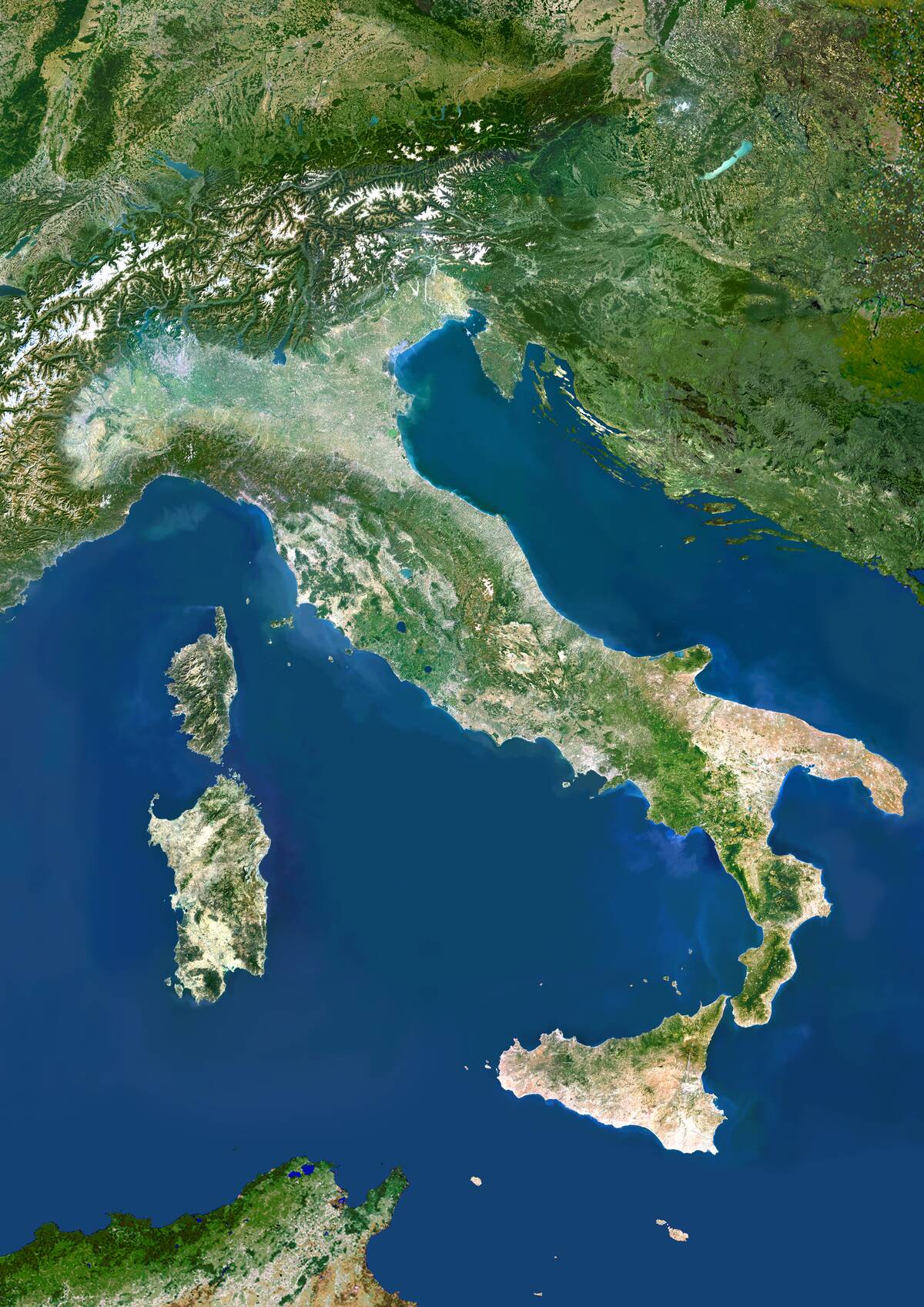
Vatican City neighbors Rome, which means that it is one of only three nations in the world to be landlocked within a single country’s borders. However, it’s also not the only nation in Italy with this unusual distinction.
That’s because Italy’s geographical borders also host the micronation of San Marino, which is surrounded by north-central Italy. According to the BBC, it’s one of the world’s oldest republics, and its political borders are a reflection of the days when Italy was a college of city-states rather than the unified country it is today.
In Literal Terms, America’s Largest Cities Are In Alaska
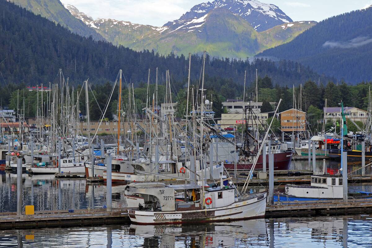
Although no city in Alaska could ever hope to compete with New York City and Los Angeles in terms of population, The Last Frontier dominates the top five for the largest cities in the United States once surface area is taken into account.
According to the World Population Review, Sitka, Alaska, is America’s most vast city, with an area of 2,870 square miles, while Juneau takes second place at about 2,701 square miles. The next spots are taken by Wrangell and Anchorage (2,542 square miles and 1,704 square miles, respectively). Jacksonville, Florida, rounds out the top five with an area of 747 square miles.


