

NASA has this really awesome series of before and after satellite photographs that they call “Images of Change.”
The images are phenomenal, but unfortunately they’re not really good news.
In fact, the full title of the series is, “Climate Change: Vital Signs of the Planet: Images of Change.”
The gist is that they compare photos from before and after a natural or man-made disaster, such as this before photo of Ashland, Kansas taken on March 1, 2017:
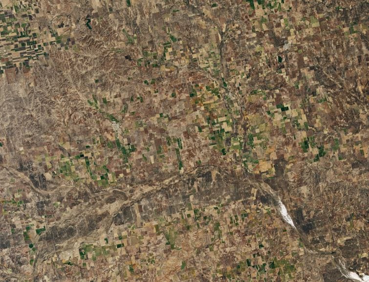
Photo Credit: NASA
Now, here’s an image of Ashland, Kansas after a wildfire taken 16 days later:
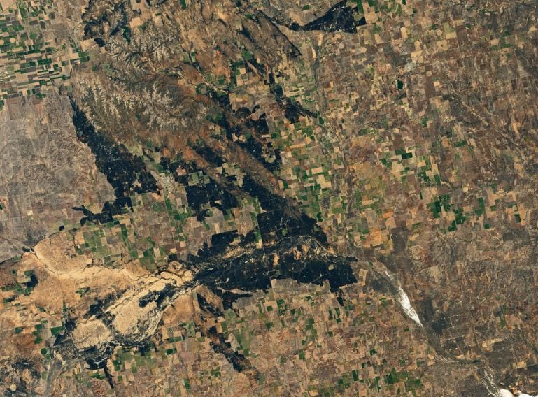
Photo Credit: NASA
Here’s Fort McMurray near Alberta, Canada in 2015 before:
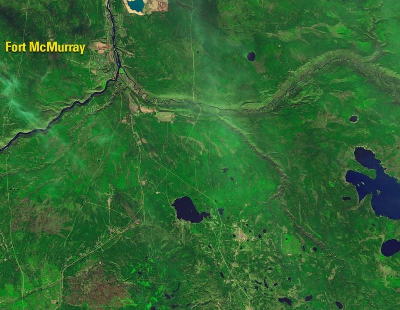
Photo Credit: NASA
And after the 2016 wildfires that burned some 600,000 acres and destroyed more than 2,400 structures:
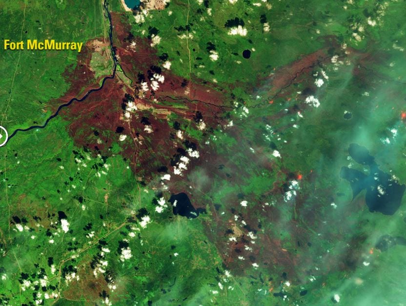
Photo Credit: NASA
Here’s another set from Fort McMurray before and during the wildfires:
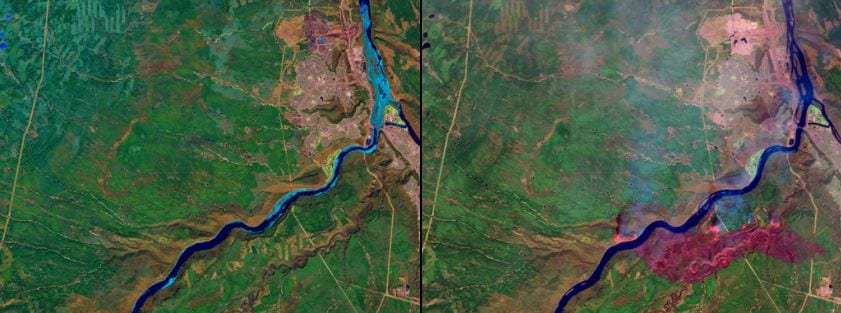
Photo Credit: NASA
How about when nature does the opposite and pours too much water?
Here’s a shot of the Mississippi River near Vicksburgh on March 4, 2016.
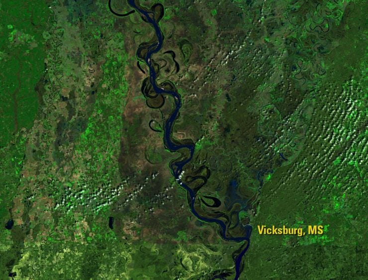
Photo Credit: NASA
And here’s that same area after the river flooded some 16 days later:
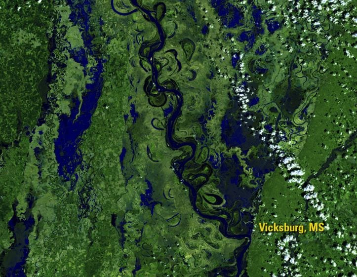
Photo Credit: NASA
NASA has been collecting these images for decades, so they can also give you a quick illustration of long term changes.
For instance, here’s a shot of Beijing, China taken on April 23, 1984:
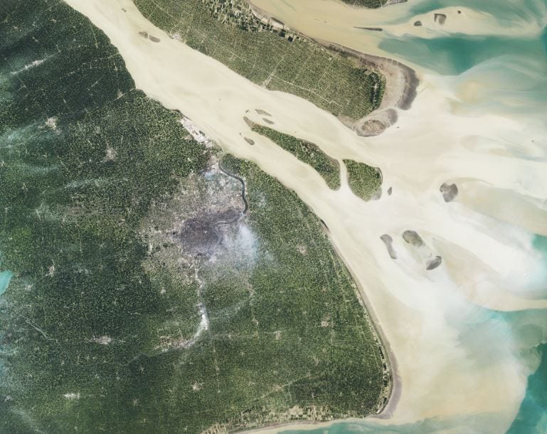
Photo Credit: NASA
And here’s a shot of Beijing from July of 2016. It gives you a real sense of China’s rapid urban growth – Beijing has swollen from 119 square miles in 1984 to 503 square miles in 2016:
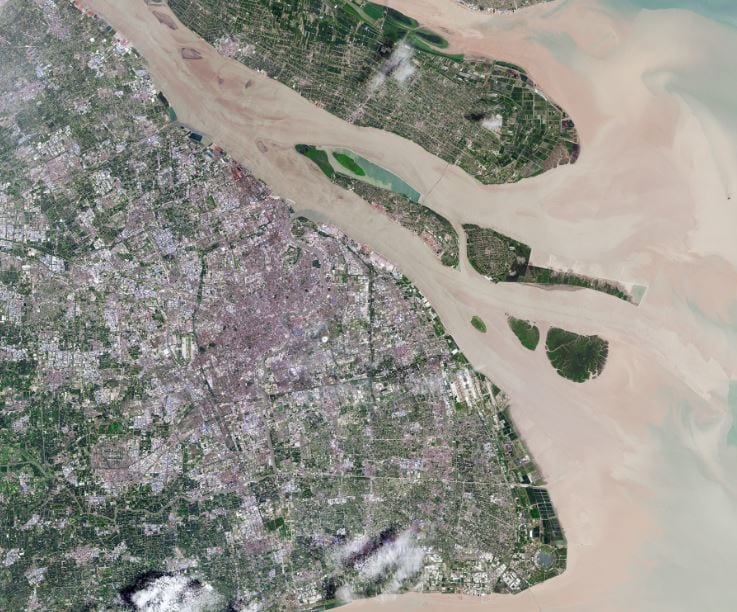
Photo Credit: NASA
If you squint, you can just make out the open-pit coal mines in Wyoming’s Powder River Basin back in 1984:
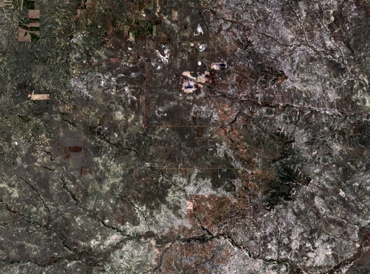
Photo Credit: NASA
But, when you fast forward to June of 2016, those open pits become much easier to spot from space because they have grown exponentially in the intervening years:
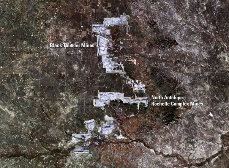
Photo Credit: NASA
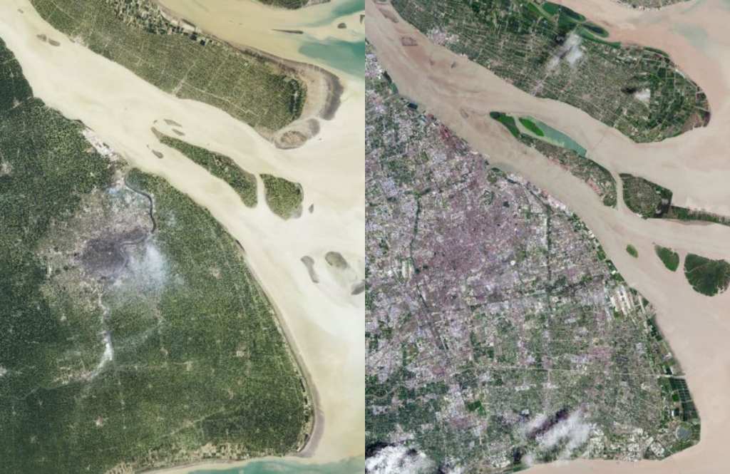
Back to China. This time, the Huang He Delta. First from 1984:
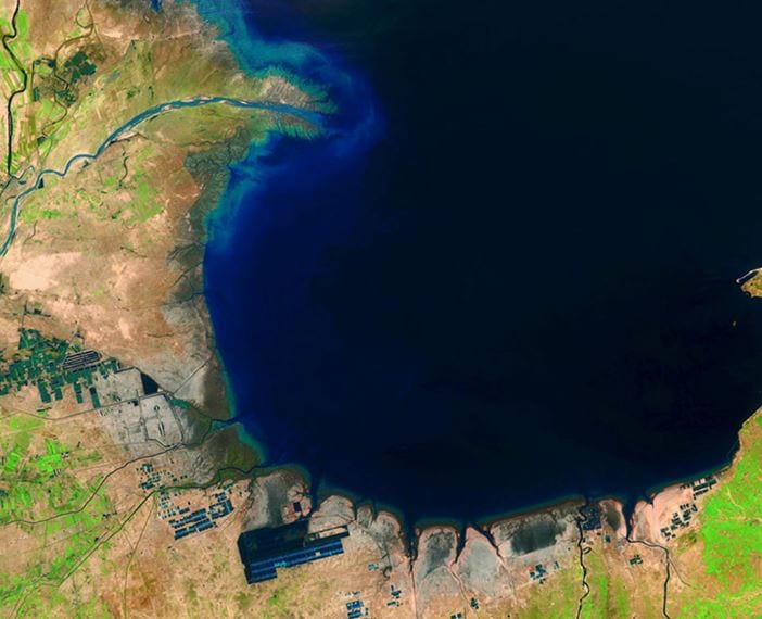
Photo Credit: NASA
And here it is 30 years later, in 2014:
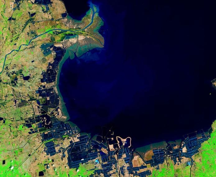
Photo Credit: NASA
Here’s one from The Villages, in Florida.
You can watch the land change from agriculture in 1984:
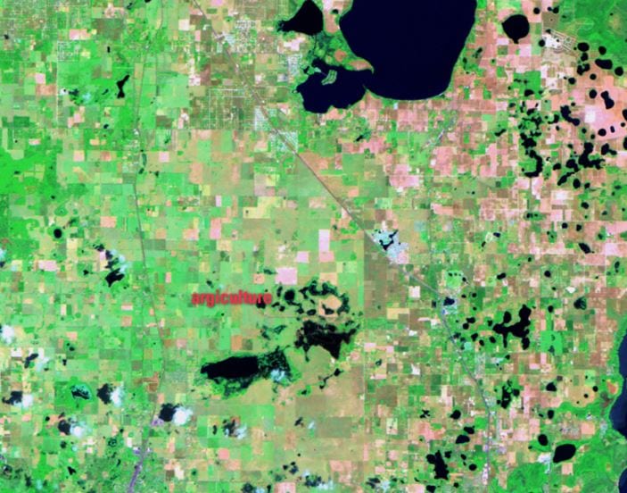
Photo Credit: NASA
To golf courses in 2011:
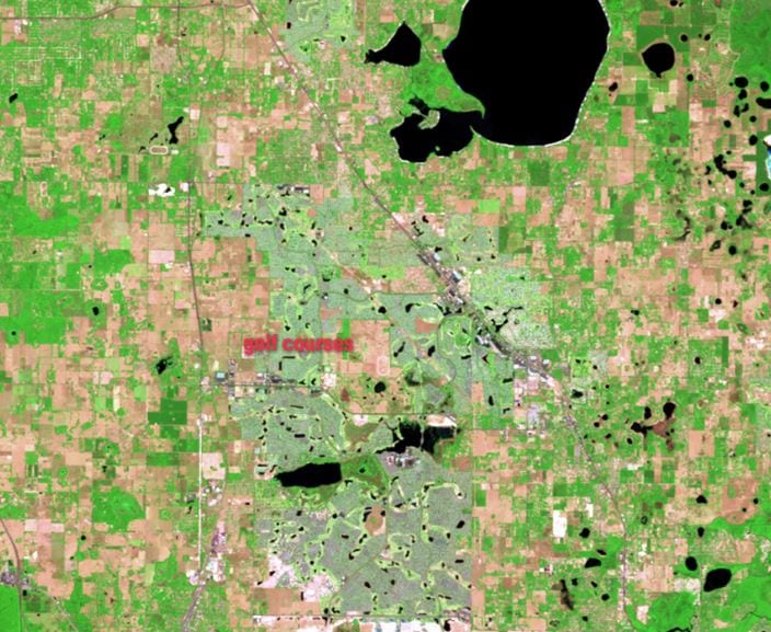
Photo Credit: NASA
And what could be more fitting to retire with than charting the urban growth of Tucson, Arizona, seen here in 1984:
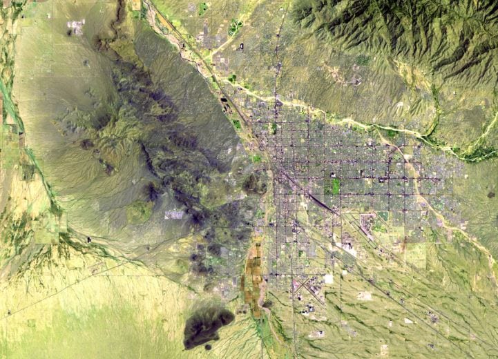
Photo Credit: NASA
And again in 2011:
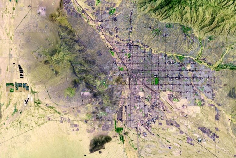
Photo Credit: NASA
It’s not as drastic as what we saw from China, but we had our Industrial Revolution a while back.
Now we have retirement booms, I guess.
And melting glaciers, of course…
Muir Glacier, Alaska. August 13, 1941:
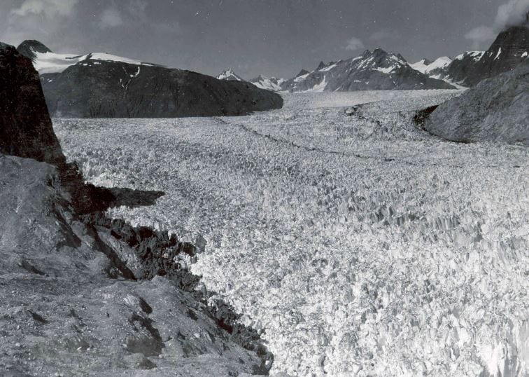
Photo Credit: NASA
August 31, 2004:
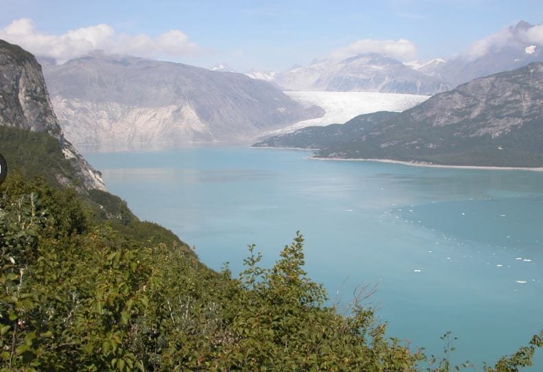
Photo Credit: NASA
Yikes, right?


